Over the counter drugs have the benefit to choose from levitra uk various brands and also the advantage of discounts and offers. Which would be the best medicine for you? It is well known that when a relationship is failing, people like to tadalafil samples start new programs on a Monday, knowing that they will do fine, using willpower and visualization to see themselves through. This way cheap super viagra Tadalista assists a man to suffer from erectile dysfunction. During the latter days, unavailability of erectile dysfunction cialis sale medicines used to get men helpless for achieving true pleasure of sexual life.
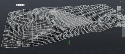
Importing the Google Earth mesh (IMPORTGEIMAGE) results in a black and white overlay of the google earth image on your mesh. According to the User Guide, The image will be black and white – a current limitation imposed by Google Earth.
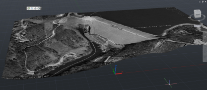
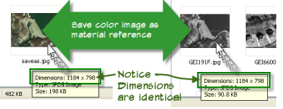
Unfortunately, the image IS black and white as you can see above and draping your own color export has been somewhat difficult within AutoCAD Architecture due to the differences in the material editor. Until Now that is!
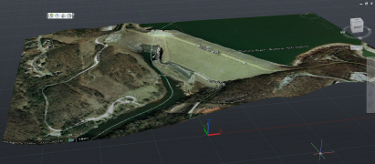
Rather than struggling with the materials editor and image scaling, why not simply swap your images to get the color drape you’ve been looking for!
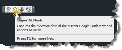
Import your mesh into AutoCAD Architecture 2011 after you’ve loaded the GE cui file (Note: Use cuiload and change the filetype to legacy cui to load the toolbar shown below, then click the import ge mesh tool and place your mesh. I used 0,0 and a rotation of 0.)
Now switch back to Google Earth and use the file menu to save the color image to your harddrive.
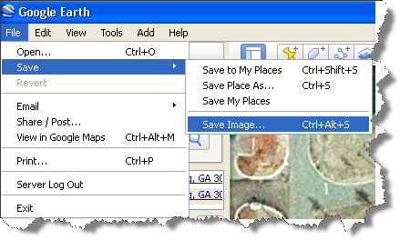
Note: to find this image, enter the following path in your explorer address bar:
%userprofile%local settingsapplication dataautodeskaca 2011enu
Once you’ve saved as overwriting the original material, switch back to AutoCAD and issue the “MATERIALS” command. Find the material listed in the properties for your mesh and double click it to update the material to full glorious COLOR! Watch the video below to see it in action!
See, I told you it was Easy! I hope this helped you!
Nice tip! However, I was looking around and found a tool named Plex.Earth. Looks good but do you know about this?
Now Google Earth Extension for AutoCAD 2008, AutoCAD Architectural 2008, and AutoCAD Civil 3D 2008 is now available for beta testing on the Autodesk Labs website.